
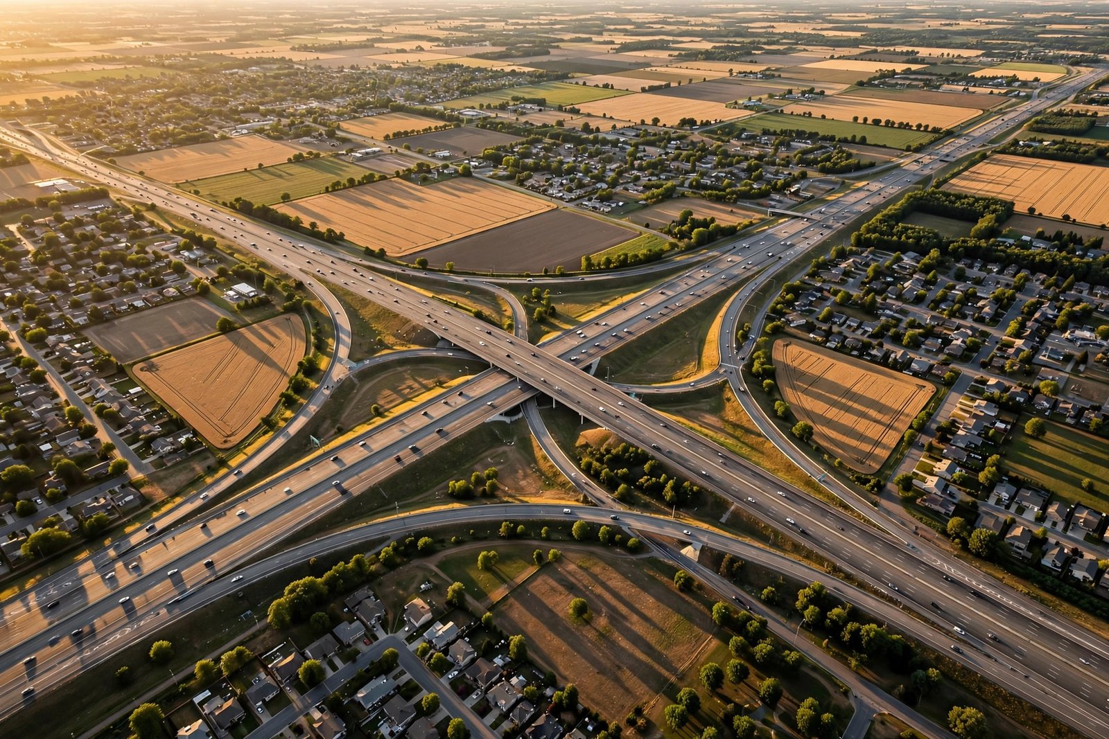
On a summer evening in 1956, President Dwight D. Eisenhower signed a law that quietly reshaped the United States forever. The US interstate highway system began as a defense project, but it grew into the largest public works effort in American history — a web of concrete and steel that connects every corner of the country, moves trillions of dollars in goods, and makes the great American road trip possible.
Today, more than 46,000 miles of interstate highways carry commuters to work, truckers to warehouses, families to national parks, and soldiers to bases. It is easy to take this network for granted. We merge onto an on-ramp, follow green signs, and arrive hours later without thinking about the engineering, politics, and vision behind the road beneath our tires. Yet this system is one of the clearest expressions of American power: the power to build big, to connect a continent, and to keep an economy moving.
In this guide, we explore how the interstates were born, how they power the economy, how they changed American life, and what challenges they face today. Whether you drive them every day or only on vacation, you will never see those green highway signs the same way again.
What Is the US Interstate Highway System?
The interstate system is a network of controlled-access highways that links major cities, ports, airports, and military bases across all 50 states. Unlike ordinary roads, interstates have no traffic lights, no stop signs, and no direct driveway access. Traffic enters and exits only through ramps, which keeps vehicles moving at high speeds and greatly reduces collisions.
Interstate routes are marked by the familiar red, white, and blue shield. Even-numbered interstates generally run east to west, with lower numbers in the south and higher numbers in the north. Odd-numbered interstates generally run north to south, with lower numbers in the west and higher numbers in the east. Three-digit interstates are shorter helper routes that loop around or spur into cities. Once you learn this simple code, you can read a map of America almost like a grid.
The system includes some of the busiest and most famous roads in the world. Interstate 95 runs from Miami, Florida, to Houlton, Maine, connecting the great cities of the East Coast. Interstate 5 runs from San Diego, California, to Blaine, Washington, hugging the Pacific Coast. Interstate 90, the longest route, stretches from Boston, Massachusetts, to Seattle, Washington. Together, these roads and hundreds of others form a single national network.
What makes the system remarkable is not just its size but its consistency. A driver can cross from New Jersey to California on high-quality, limited-access highways with standardized signs, lane markings, rest areas, and emergency services. That consistency is a quiet kind of power. It means a truck carrying medicine can travel thousands of miles on a predictable schedule, and a family can plan a cross-country vacation with confidence.
How the US Interstate Highway System Was Born
The story of the interstates begins long before 1956. In 1919, a young Army officer named Dwight D. Eisenhower took part in a military convoy that drove from Washington, D.C., to San Francisco. The trip took 62 days and was a miserable ordeal of mud, broken bridges, and bad roads. Eisenhower never forgot it. Years later, during World War II, he saw Germany’s autobahn network and was impressed by how quickly troops and supplies could move on high-speed, limited-access highways.
When Eisenhower became president, he pushed for a national highway program. The Federal-Aid Highway Act of 1956 authorized 41,000 miles of interstate highways and created the Highway Trust Fund, paid for largely by a federal tax on gasoline. The federal government would pay 90 percent of construction costs, with states covering the remaining 10 percent. It was a bold partnership between Washington and the states, and it launched decades of construction.
The original goals were practical. The highways would support national defense by moving troops and evacuating cities in an emergency. They would reduce traffic deaths on older, dangerous two-lane roads. They would connect farms to markets, factories to ports, and workers to jobs. Over time, the system grew beyond its original plan, reaching more than 46,000 miles and becoming the backbone of American mobility.
Building the interstates was not without controversy. In many cities, highway construction cut through established neighborhoods, displacing families and businesses. Historians and planners still debate those choices today, and modern projects often include efforts to reconnect communities divided by old highways. Understanding this complicated history is part of understanding the full story of American infrastructure.
How Interstates Power the American Economy
If you have ever ordered something online and received it in two days, you have the US interstate highway system to thank. Trucks carry the overwhelming majority of freight in the United States, and interstates are their main arteries. From the ports of Los Angeles and Long Beach to warehouses in Texas and distribution centers in Ohio, goods flow along interstate corridors day and night.
Consider a simple example. Fresh produce grown in California’s Central Valley travels east on Interstate 5 and Interstate 40 to grocery stores across the country. Auto parts made in Michigan ride south on Interstate 75 to assembly plants in Kentucky and Tennessee. Packages ordered in New York move west on Interstate 80 toward homes in the Midwest. Without this network, shipping would be slower, more expensive, and far less reliable.
The interstates also support American manufacturing and agriculture by connecting rural areas to national and global markets. A small factory in Iowa can ship products to customers in Florida or Washington because a reliable highway is nearby. A farmer in Kansas can reach grain terminals and export facilities without depending on a single local road. This connectivity helps small towns compete in a national economy.
Beyond freight, interstates create jobs directly. Construction, maintenance, trucking, logistics, gas stations, restaurants, hotels, and roadside attractions all depend on highway traffic. Many American towns grew up around interstate exits, with clusters of businesses serving travelers. The highway economy is so woven into daily life that it is almost invisible — until a closure or detour reminds us how much we depend on it.
For travelers dreaming of a long drive, the interstates also make legendary journeys possible. If you love the romance of the open road, our Route 66 road trip guide shows how America’s most famous highway connects to the modern interstate network, and our American road trip bucket list is full of routes that mix historic roads with smooth interstate miles.
The Interstate System and American Travel Freedom
Before the interstates, a long-distance drive in America was an adventure in the hardest sense. Roads were narrow, poorly marked, and often unpaved. A trip from Chicago to St. Louis could take an entire day. Today, that same drive takes a few hours on smooth, well-signed highways. That change transformed how Americans think about distance.
The interstate system made weekend trips, family vacations, and cross-country moves practical for millions of people. Families could drive from Ohio to Florida for spring break. College students could move across the country for school. Retirees could load an RV and tour national parks from Yellowstone to the Grand Canyon. The highway made the whole continent feel closer.
This freedom also shaped American culture. Roadside diners, motels, drive-in theaters, and national park lodges became part of the national story. Songs, movies, and books celebrated the open road. The idea that you could get in a car and go anywhere — from the beaches of California to the mountains of Colorado — became a powerful symbol of American independence.
Interstates also support tourism in a very practical way. Visitors can fly into a major city, rent a car, and reach small towns, scenic byways, and natural wonders within hours. Many of the most beautiful places in America are best reached by car, and the interstate network is the first step on the journey. Without it, tourism to rural and remote destinations would be far more difficult.
Defense, Safety, and National Strength
National defense was one of the original reasons for building the interstates, and it remains important today. Military bases across the country are connected to the highway network, allowing troops, vehicles, and equipment to move quickly when needed. In an emergency, highways can support evacuations, disaster relief, and the delivery of emergency supplies.
Hurricane evacuations offer a powerful example. When storms threaten the Gulf Coast or the Atlantic seaboard, state officials use interstate highways to move large numbers of people inland. Contraflow plans, in which all lanes are directed away from danger, can dramatically increase evacuation capacity. These plans have saved lives during major storms.
The interstates also improved road safety in important ways. Limited-access design, wide medians, gentle curves, clear signs, and standardized guardrails all reduce the risk of serious crashes compared with older roads. While speeding and distracted driving remain serious problems, the engineering of interstates has prevented countless deaths over the decades.
In addition, the system supports national unity in a less obvious way. When every state is connected by the same high-quality network, the country feels like one nation rather than a collection of distant regions. A truck driver, a military family, or a tourist can travel from Maine to Texas without ever leaving the same system. That sense of connection is part of what makes the United States feel united.
Famous Routes and Engineering Marvels
Some interstate highways are famous in their own right. Interstate 95 is the busiest corridor in the country, carrying millions of people through Boston, New York, Philadelphia, Washington, and Miami. Interstate 5 connects the West Coast’s great cities and offers stunning views of mountains, valleys, and farmland. Interstate 70 crosses the Rocky Mountains through the spectacular Glenwood Canyon in Colorado, a stretch often called one of the most beautiful highway segments in America.
Engineering feats abound. The Eisenhower Tunnel on Interstate 70 in Colorado passes beneath the Continental Divide at more than 11,000 feet above sea level, making it one of the highest vehicular tunnels in the world. The Chesapeake Bay Bridge-Tunnel carries Interstate 64 traffic across the mouth of the Chesapeake Bay on a series of bridges and tunnels. The Big I interchange in Albuquerque, New Mexico, stacks multiple levels of ramps in a striking display of modern engineering.
Bridges are another highlight. The system includes thousands of bridges, from short overpasses to massive river crossings like the Mississippi River bridges at St. Louis and Memphis. Maintaining these bridges is a constant job, and engineers inspect them regularly to keep traffic safe.
Even rest areas deserve appreciation. Modern rest stops offer clean bathrooms, picnic areas, pet exercise zones, and traveler information. In some states, they feature scenic overlooks, historic markers, and local art. For long-distance drivers, a well-maintained rest area is a welcome break and a small reminder that the highway system was designed for people, not just vehicles.
Challenges Facing the System Today
After nearly 70 years, the interstate system faces serious challenges. Much of the original pavement and many bridges are aging and need repair or replacement. Traffic volumes are far higher than the original planners imagined, especially around growing cities like Atlanta, Dallas, Phoenix, and Charlotte. Congestion costs drivers time and businesses money.
Funding is another challenge. The Highway Trust Fund, which pays for much of the system, depends on fuel taxes that have not kept pace with inflation, construction costs, or the rise of more fuel-efficient and electric vehicles. Policymakers debate how to fund maintenance and improvements fairly, including options like mileage-based fees, tolls, and public-private partnerships.
There are also questions about how highways fit into modern cities. Some urban areas are rethinking wide highways that divide neighborhoods, exploring options like capping highways with parks, adding transit, or redesigning interchanges to be safer for pedestrians and cyclists. These debates reflect a broader conversation about what kind of transportation system America needs in the 21st century.
Climate change adds further pressure. Flooding, extreme heat, wildfires, and coastal storms can damage roads and bridges. Engineers are now designing pavements and drainage systems to handle more extreme weather, and states are working to make key routes more resilient.
The Future of America’s Highways
Despite these challenges, the future of the interstate network is full of innovation. Smart highway technology is already appearing along the US interstate highway system in some places. Sensors, cameras, and digital signs can warn drivers about crashes, congestion, and weather ahead. Connected-vehicle technology may one day allow cars and trucks to communicate with each other and with the road itself, reducing crashes and smoothing traffic flow.
Electric vehicle charging stations are spreading along interstate corridors, making long-distance electric travel practical. The federal government and private companies are building fast-charging networks at highway rest stops, gas stations, and shopping centers near exits. As more Americans switch to electric cars, the highway system is adapting to new kinds of fuel.
Truck platooning, in which connected trucks travel closely together to save fuel, is being tested on several routes. Self-driving trucks may eventually handle long, monotonous stretches of interstate driving, with human drivers handling local delivery. These technologies could make freight more efficient, though safety and jobs remain important concerns.
Perhaps most importantly, planners are thinking about the interstate system as part of a larger transportation network that includes passenger rail, public transit, airports, and bike paths. The goal is not just to move cars faster but to give Americans more choices for how to travel. In that vision, the interstates remain essential — the backbone that ties everything together.
The US interstate highway system will continue to evolve, but its core mission remains the same: to connect people, support the economy, and strengthen the nation. The next time you drive onto an interstate, remember that you are traveling on one of the greatest engineering achievements in American history.
Conclusion: The Road That Built Modern America
From a difficult 1919 convoy to a 46,000-mile network, the interstate highway system tells a story of American ambition, ingenuity, and persistence. It carries our food, our goods, our families, and our dreams. It connects small towns to big cities, coasts to heartland, and Americans to one another.
If this story inspires you to hit the road, start planning your next adventure. Explore our American road trip bucket list for unforgettable routes, and check our Route 66 road trip guide for a classic journey through American history. Then get in the car, pick a direction, and discover the power of the open road for yourself.
Have a favorite interstate drive? Share it in the comments and tell us where the highway has taken you. And if you found this guide helpful, share it with a friend who loves road trips — America is waiting.